Annual report of the United States Geological Survey to the Secretary of the Interior
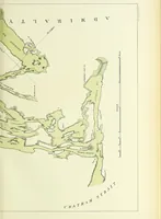
A volume of the U.S. Geological Survey's annual report to the Secretary of the Interior, issued by the Government Printing Office in Washington from 1880 onward for Congress, federal administrators, and working geologists. The plate here is a lithographed coastal map of southeastern Alaska, with Admiralty Island and Chatham Strait labelled in spaced letterpress capitals, land masses filled in flat pale green against a blank sea, and a ruled bar scale — useful for shoreline outlines, engraved map lettering, and single-tint cartographic fills.