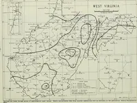
Climatological data, West Virginia
A monthly government weather serial for West Virginia, compiled by the U.S. Weather Bureau and later the Environmental Data Service and printed for stations, farmers, and officials tracking rainfall and temperature. The plates are state maps drawn in fine line: isohyetal contours enclosing shaded highs, small station symbols, dotted climate-division borders, and boxed legends and inset diagrams useful as ready-made cartographic texture.