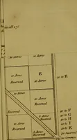
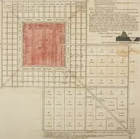
A general plan for laying out towns and townships, on the new-acquired lands in the East Indies, America, or elsewhere; in order to promote cultivation, and raise the value of all the adjoining land ..
A 1794 London pamphlet by the abolitionist and reformer Granville Sharp, proposing a standard grid layout for towns and townships on land newly taken in the East Indies and America, addressed to colonial administrators and land speculators. The plates are surveyor's diagrams — squared blocks labelled by acreage, reserved lots, diagonal roads, common land — set beside letterpress tables of measurements with large curly braces and columns of figures; useful for grid patterns, cartographic lettering, and typographic bracket ornaments.