Investigations using data in Alabama from ERTS-A, volume 1
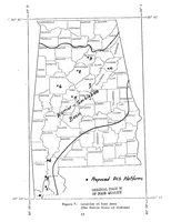
A 1974 NASA technical report, volume one of a study applying ERTS-A (Landsat) satellite data to land and water resources in Alabama, issued for federal and state agency readers. The single plate is a stippled photocopy of a line-drawn county map of the whole state, with labelled county names, a hand-lettered "Warrior-Tombigbee Basin" band, latitude and longitude ticks, and dotted markers for proposed data collection platforms \u2014 useful for typewriter-era map graphics, hand lettering over contours, and degraded reprographic texture.