Maps and map-making; three lectures delivered under the auspices of the Royal geographical society (1910)
Reeves, Edward Ayearst, 1862-1945, Royal Geographical Society (Great Britain) · London, The Royal geographical society · leaf 26
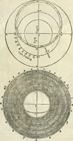
e he obtained differsnot more than one minute from the true latitude of Mar-seilles Observatory. For the latitudes for the rest of hisvoyage he depended upon the oldest of all known methods,that is the comparative lengths of the days. Perhaps the most famous of all the old instrumentsis the… … 8 MAPS AND MAP-MAKING in use up to the sixteenth or seventeenth century in someform or another, to be only finally superseded by thequadrant and sextant in the eighteenth century. The Astrolabe (Figs. 6 and 7) consisted of a somewhatheavy circular metal ring with inlet plates and discs fordifferent…
Cartography · Surveying
Internet Archive · Wellesley College Library · Public Domain Mark 1.0. Free to use for anything.