Maps and map-making; three lectures delivered under the auspices of the Royal geographical society (1910)
Reeves, Edward Ayearst, 1862-1945, Royal Geographical Society (Great Britain) · London, The Royal geographical society · leaf 78
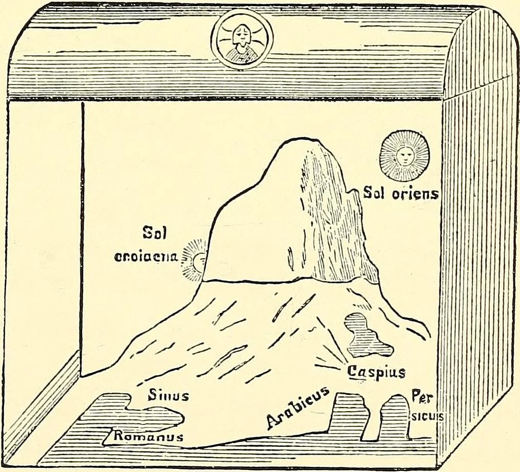
old that itwent all the waydown to the bottom,or something of thatkind. During the darkdays of the MiddleAges, science and natural philosophy, like most other things,were lost in superstition and obscurity. The spherical ideaof the earth was sup-posed to be not in ac-cordance with Scrip-ture, and… … Fig. 64.—Cosmas World, a.d. 538.{From Gores Geodesy.) The habitable regions were represented as a parallelogramsurrounded by an ocean ; on the four edges of the earthrise four walls which enclose it, while the top forms the 60 MAPS AND MAP-MAKING heavens. The sun was supposed to pass behind a…
Cartography · Surveying
Internet Archive · Wellesley College Library · Public Domain Mark 1.0. Free to use for anything.