The mariners' handbook; a convenient reference book for navigators, yachtsmen, and seamen of all classes (1906)
International Correspondence Schools, Roden, Ernest Konrad, 1866-, International Correspondence Schools. Pocketbook · Scranton, Pa. : International Textbook Co. · leaf 149
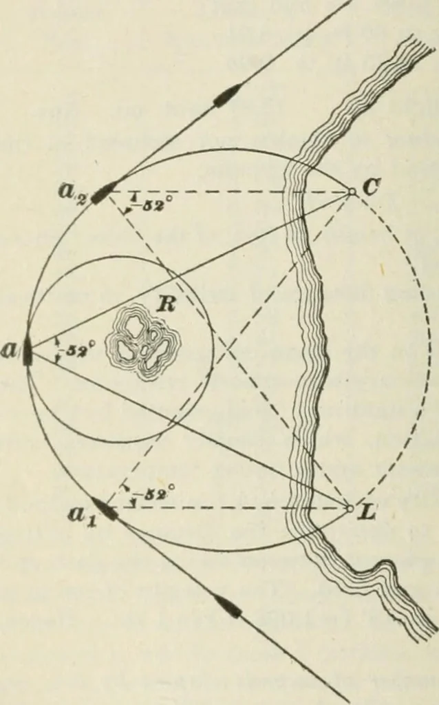
tant isthen set and clampedat that angle andthe vessels coursealtered so that theangle will remain theFig. 2 same. If the angle referred to becomes larger, the ship is inside the 2-mi. limit;if smaller it is outside, or the distance of the ship from theobject is greater than 2 mi. The horizontal… … TERRESTRIAL NAVIGATION 117 when steaming along a coast it is necessary to avoid somehidden rocks R, Fig. 2, by passing ^ mi. outside of them.On the shore, there are two known objects in sight, a light-house L and a church C, both being marked on the chart.Then, to find the danger angle…
Navigation
Internet Archive · California Digital Library · Public Domain Mark 1.0. Free to use for anything.