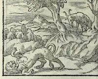
The mariners mirrour : wherin may playnly be seen the courses, heights, distances, depths, soundings, flouds and ebs, risings of lands, rocks, sands and shoalds, with the marks for th'entrings of the harbouroughs, havens and ports of the greatest part of Europe: their seueral traficks and commodities: together w.th the rules and instrume[n]ts of navigation. (1588)
Waghenaer, Lucas Janszoon, 1534 or 1535-1606 · [London : Printed by John Charlewood] · leaf 201
a I ——E Ee 2 2 a 4 Ne ae ee ss Saas ee = Fie Ns ES CRS. cm Fy SOKA | = af abate PEF S_ a8 ee aan { Yur.¥ eo Eo ind Py LR Me Ge SP LAY OI Me EEL ERY die BES … as as as ae aS ass eee > aa Sa aes > aa a i Faso? EAU Aree RRL Et bY ee EE 2> RIGHISHE Ferwalen eT —— oe nglifhe es ded — im a rate x 2 4 ig Pot tee Spanif? ¢ leagues 17 $n adegeee (24 z 5 Hike tiene ss = = = Dutche leagues IS 172 ackqvee : % \ — PP silk denchelheteladedebahedeckohckabebabeted Ne…
Navigation · Nautical charts -- Europe · Atlases -- Netherlands · Early maps · Imprint 1588
Internet Archive · John Carter Brown Library · Public domain (published before 1931). Free to use for anything.
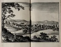
![An illustration from The mariners mirrour : wherin may playnly be seen the courses, heights, distances, depths, soundings, flouds and ebs, risings of lands, rocks, sands and shoalds, with the marks for th'entrings of the harbouroughs, havens and ports of the greatest part of Europe: their seueral traficks and commodities: together w.th the rules and instrume[n]ts of navigation., 1588, leaf 201](https://img.insideoutlibrary.com/img/1024/ia-marinersmirrourw00wagh-201-0.webp)
![An illustration from Brevis narratio eorum quae in Florida Americae provi[n]cia Gallis acciderunt, : secunda in illam nauigatione, duce Renato de Laudo[n]niere classis praefecto anno M D LXIIII. Quae est secunda pars Americae. Additae figurae et incolarum eicones ibidem ad vivu[m] espressae brevis item declaratio religionis, rituum, vivendique ratione ipsorum. (1591)](https://img.insideoutlibrary.com/img/200/ia-brevisnarratioeo00lemo_1-75-0.webp)
![An illustration from Catalogvs annorvm et principvm siue monarcharvm mvndi geminvs : plerisqve in locis obscvrioribus illustratus & in caelebrioribus locupletatus atq[ue] à mendis, recognitione diligenti repurgatus : cum accessione multorum aliorum quae in priori aeditione non continebantur, quemadmodum suis locis toto libro uidere licebit, ab homine condito, usq[ue] in praesentem, à nato Christo, millesimum quingentesimum & quinquagesimum annum deductus & continuatus (1550)](https://img.insideoutlibrary.com/img/200/ia-gri_33125008666402-39-1.webp)