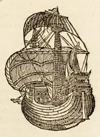
The mariners mirrour : wherin may playnly be seen the courses, heights, distances, depths, soundings, flouds and ebs, risings of lands, rocks, sands and shoalds, with the marks for th'entrings of the harbouroughs, havens and ports of the greatest part of Europe: their seueral traficks and commodities: together w.th the rules and instrume[n]ts of navigation. (1588)
Waghenaer, Lucas Janszoon, 1534 or 1535-1606 · [London : Printed by John Charlewood] · leaf 205
G Ey Sy TOO SS, ) d caled C urland 7 rom the } erthy j he A > es hackbo fan and t fs Pept pe rie oF J hen you G ) Boy notes Yxto ULTI OF ae 2. S eee a. CuEn Coafte about? the Fle ca Se/ led O C. sie he With a part of Arr oort rtto from D guung (gj oy th Countre do 16 as th de be OWinde eu [4 … i} wee ae HIS =CGG= OK > CWE WH TPG a Sw po san ee 25) i Biggie
Navigation · Nautical charts -- Europe · Atlases -- Netherlands · Early maps · Imprint 1588
Internet Archive · John Carter Brown Library · Public domain (published before 1931). Free to use for anything.