The mariners mirrour : wherin may playnly be seen the courses, heights, distances, depths, soundings, flouds and ebs, risings of lands, rocks, sands and shoalds, with the marks for th'entrings of the harbouroughs, havens and ports of the greatest part of Europe: their seueral traficks and commodities: together w.th the rules and instrume[n]ts of navigation. (1588)
Waghenaer, Lucas Janszoon, 1534 or 1535-1606 · [London : Printed by John Charlewood] · leaf 21
Navigation · Nautical charts -- Europe · Atlases -- Netherlands · Early maps · Imprint 1588
Internet Archive · John Carter Brown Library · Public domain (published before 1931). Free to use for anything.
![An illustration from The mariners mirrour : wherin may playnly be seen the courses, heights, distances, depths, soundings, flouds and ebs, risings of lands, rocks, sands and shoalds, with the marks for th'entrings of the harbouroughs, havens and ports of the greatest part of Europe: their seueral traficks and commodities: together w.th the rules and instrume[n]ts of navigation., 1588, leaf 21](https://img.insideoutlibrary.com/img/1024/ia-marinersmirrourw00wagh-21-0.webp)
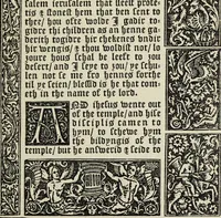
![An illustration from The myrrour & dyscrypcyon of the worlde : with many meruaylles & the vii scyences as gramayre, rethorike wyth the arte of memorye, logyke, geometrye, wyth the standarde of mesure & weyght, and the knowlege how a man sholde mesure londe, borde, & tymber, and than arsmetryke wyth the maner of accou[n]tes and rekenynges by cyfres, and than musyke, and astrnomye, with many other profytable and plesant co[m]modytes (1527)](https://img.insideoutlibrary.com/img/200/ia-myrrourdyscrypcy00goss-110-0.webp)

![An illustration from A booke of Christian prayers, : collected out of the auncie[n]t writers, and best learned in our tyme, worthy to be read with an earnest mynde of all Christians, in these daungerous and troublesome dayes, that God for Christes sake will yet still be mercyfull vnto vs. (1578)](https://img.insideoutlibrary.com/img/200/ia-bookeofchristian00dayr-294-0.webp)
![An illustration from A booke of Christian prayers, : collected out of the auncie[n]t writers, and best learned in our tyme, worthy to be read with an earnest mynde of all Christians, in these daungerous and troublesome dayes, that God for Christes sake will yet still be mercyfull vnto vs. (1578)](https://img.insideoutlibrary.com/img/200/ia-bookeofchristian00dayr-57-0.webp)