The mariners mirrour : wherin may playnly be seen the courses, heights, distances, depths, soundings, flouds and ebs, risings of lands, rocks, sands and shoalds, with the marks for th'entrings of the harbouroughs, havens and ports of the greatest part of Europe: their seueral traficks and commodities: together w.th the rules and instrume[n]ts of navigation. (1588)
Waghenaer, Lucas Janszoon, 1534 or 1535-1606 · [London : Printed by John Charlewood] · leaf 41
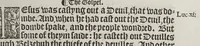
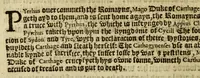
Frown Fhence to the Jes of Salrcys on the coattes … from Blakem bnto the Jies called Arran, North From the Barlinges {n Portugal to the Fle Canarie, fouth fouth-wett, —_—_ 1eag.176 north-eaft, — leag.14 ‘From the les of Arran fo Galwicke,o2 the Galfe From the Ble of Madera fo Calis Malis, E.n.eleag.iso Frown Calisto CapedeCantin, s w. EbYs, leag.os…
Navigation · Nautical charts -- Europe · Atlases -- Netherlands · Early maps · Imprint 1588
Internet Archive · John Carter Brown Library · Public domain (published before 1931). Free to use for anything.
![An illustration from The mariners mirrour : wherin may playnly be seen the courses, heights, distances, depths, soundings, flouds and ebs, risings of lands, rocks, sands and shoalds, with the marks for th'entrings of the harbouroughs, havens and ports of the greatest part of Europe: their seueral traficks and commodities: together w.th the rules and instrume[n]ts of navigation., 1588, leaf 41](https://img.insideoutlibrary.com/img/1024/ia-marinersmirrourw00wagh-41-0.webp)
![An illustration from The rutter of the sea : with the hauens, rodes, soundings, kennings, windes, floods, and ebbes, daungers and coastes of diuers regions with the lawes of the Ile of Auleron, and y[e] iudgements of the sea. With a rutter of the north added to the same (1567)](https://img.insideoutlibrary.com/img/200/ia-rutterofseawithh00garc-38-0.webp)
![An illustration from Conqueste van Indien. : De wonderlijcke ende warachtighe historie vant coninckrijck van Peru, gheleghen in Indien, inde welcke verhaelt wordt de gelegentheydt, costuymen, manieren van leuen, ouervloedicheyt des gouts ende siluers, ende voorts alle de sonderlingste dinghen vanden seluen lande. Insgelijcks vanden steden, plaetsen ende inwoonders desselfs coninckrijcx, daer beneue[n] hoet gevonden ende eerst by de keyserlijcke mayesteyt hoochloflijcker memorien gheconquesteert ende vercreghen is, met alle de oorlogen ende strijden die ghebuert [sic] zijn, soo teghens d'Indianen als oock om tgoevernement d'een teghens den anderen (1596)](https://img.insideoutlibrary.com/img/200/ia-conquestevanindi00zrat-195-0.webp)