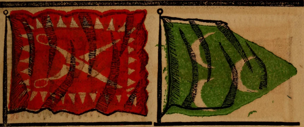
The maritime flags and standards of all nations, together with a geographical sketch (1856)
Figsbee, Alphonso. [from old catalog] · New York, A. Ranney · leaf 70
TUNIS, a maritime city of N. Africa,cap. of the kingdom, on the W. side ofthe Gulf of Tunis, 4 miles W. from theSea, and 3 miles S. W. of the ruins ofancient Carthage. •S1A-M, a country ot India, bounded N. by the Loas country, E. theempire of Anam, W. the Birmeseempire and S. gulf of Siam,… … MOROCCO, an empire which coversa tract of country in the N.W. of Africa;area, 219,300 square miles. EMPEROR, or Sultan of Morocco,the government is a gloomy despotism,the Sultan being the head of church andstate, he has no ministers, all isjloneby his command.
Flags
Internet Archive · Library of Congress · Public Domain Mark 1.0. Free to use for anything.
![An illustration from The stones of Venice : [With appendices, additional notes, and "Venetian index."] (1894)](https://img.insideoutlibrary.com/img/200/ia-stonesofvenicewi02rusk-57-7.webp)