Reports of explorations and surveys, to ascertain the most practicable and economical route for a railroad from the Mississippi River to the Pacific Ocean (1855)
United States. War Department, author · Washington [D.C.] : A.O.P. Nicholson, printer · leaf 267
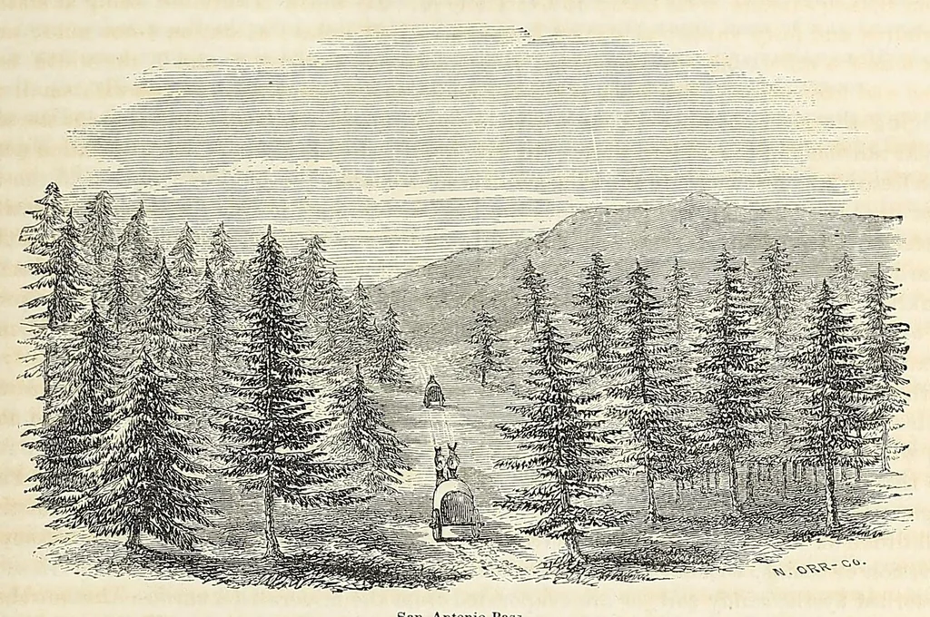
y feet grade, and from thirty-five to forty feet cutting, to attain the summit. From this summit, a little south of Las Lagunas, to the main summit of the Rocky mountains, at the San Pedro mountain, the line traverses a rolling country, descend¬ ing at an average rate per mile of about thirty-three… … San Antonio Pass. “This pass divides the waters which flow into the Rio Tuerto from those that flow into, or towards, Las Salinas. About nine miles farther is another pass or summit, which divides the waters of the Tuerto from those of the Rio San Antonio, in the Canon de Carnuel, with a forty-…
Pacific railroads -- Explorations and surveys · Discoveries in geography -- American · Natural history -- West (U.S.) · Natural history -- California · Indians of North America -- West (U.S.) · West (U.S.) -- Description and travel · California -- Description and travel · United States -- Discovery and exploration
Internet Archive · Smithsonian Libraries · Public domain (published before 1931). Free to use for anything.