The seaman's tutor, explaining geometry, cosmography, and trigonometry : with requisite tables of longitude and latitude of sea-ports, traverse tables, tables of easting and westing, meridian miles, declinarions, amplitudes, refractions, use of the compass , kalendar, measure of the earth's globe, use of instruments and charts, difference of sailing, estimation of a ship's way by the log, and log-line, currents, & c. : compiled for the use of the mathematical school in Christ's hospital-London, His Majesty Charles II, his royal foundation (1682)
Perkins, Peter · London : Obadiah Blageave · leaf 506
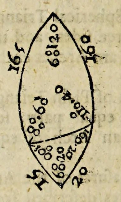
2i 2 The Tutor to Navigation, from the Circumference of its Circle;: 7, The Difiance of the Poles of two great Circles is equal to the Angle made by them ar the point of Imerfedion. Therefore 8. Thofe Circles which cut each other at Right Angles, the one of themfhallpafsby the Poles of the other,… … Hence if a Spherical Triangle hath two fidesf • each of them feverally greater than a Qua¬ drant, you (hall in the refolving thereof keep the leafl fide, with it’s oppofite Angle, and for the other two both fades and Angles, take their Complements to 1 80 deg. 10, If
Navigation -- Early works to 1800 · Imprint 1682
Internet Archive · John Carter Brown Library · Public domain (published before 1931). Free to use for anything.
![An illustration from Divina proportione : opera a tutti glingegni perspicaci e curiosi necessaria oue ciascun studioso di philosophia: prospettiua pictura sculptura: architectura: musica: e altre mathematice: suavissima: sotile: e admirabile doctrina consequira: e delecterassi: co[n] varie questione de secretissima scientia (1509)](https://img.insideoutlibrary.com/img/200/ia-divinaproportion00paci-98-208.webp)