Finch, James Kip, 1883- · New York : John Wiley & Sons, Inc. · leaf 81
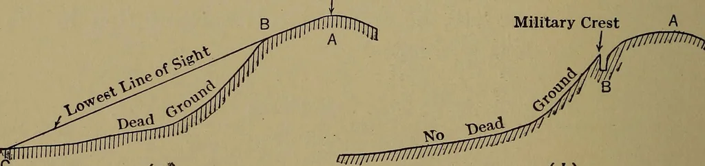
ing questions: 2. Could wagons go straight up Chestnut Hill from the south? How steep is the slope? 3. Could cavalry charge freely east of Table Rock Station? (C-8). 4. Could artillery move on every slope on this map? If not, tell where not. 5. Could infantry move on every slope on this map? Could… … {a) (b) Fig. 33.—Topographic and Military Crests. r our line of sight is cut off by some intervening hill, can bereadily determined from a contour map and is of great impor-tance in military operations. For example, in selecting signalstations, in determining whether a certain road is visiblefrom…
Cartography · Military maps
Internet Archive · Library of Congress · Public Domain Mark 1.0. Free to use for anything.