Geological and topographical maps, their interpretation and use, a handbook for the geologist and civil engineer (1911)
Dwerryhouse, Arthur Richard, 1867- · London, E. Arnold · leaf 72
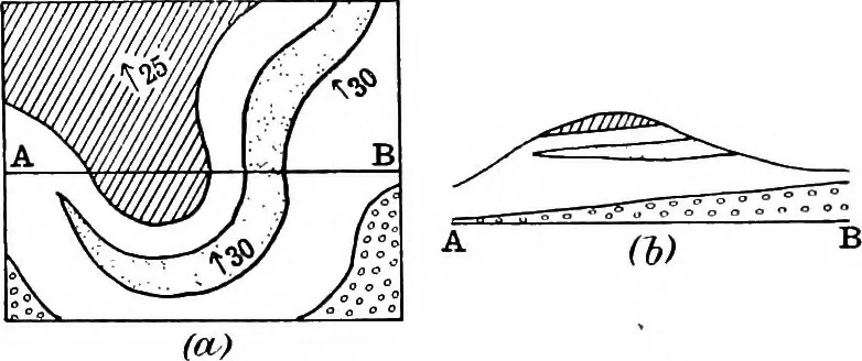
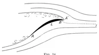
icated. Thinning out, and with more difficulty variation ofthickness, may be detected from the forms of the outcrops,but in the latter case due care must be exercised in allow-ing for variations in the width of the outcrops due tochanges in the amount of dip or in the slope of the ground. An… … Fig. 34.—Thinning out of a Bed of Rock. ment during Jurassic times, with the result that all therocks of that period thin out as they approach the axis,so that on the crown of the arch only the Lower Liasoccurs, and that in an attenuated form, while to thenorth and south the Middle and Upper Lias…
Cartography · Geology · Topographical drawing
Internet Archive · Cornell University Library · Public Domain Mark 1.0. Free to use for anything.