U.S. Army Command and General Staff College · Fort Leavenworth, Kan. : The General Service Schools Press · leaf 85
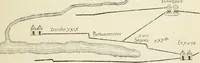
s of the sector:—The first step necessary is todetermine, by actual inspection, the limits of the sector.If the sector has been plotted on a map previously it is neces- APPLIED MILITARY SKETCHING 75 sary for the sketcher to orient himself and determine thesector limits accurately from the map.… … Re ePo fe i<J lie .!**= Kr Target Ronqs(yds) 5000 4J500 2150 6000 .^000 3 mi 3000 Def (mils) c HO i.00 ISO 2B0 340 ,5lO
Military topography · Maps, Military
Internet Archive · Library of Congress · Public Domain Mark 1.0. Free to use for anything.