Inside Out Library · Explore

The English pilot. [cartographic material] : The fourth book. Describing The West-India navigation, from Hudson's Bay to the River Amazones. Particularly delineating The Sea Coasts, Capes, Headlands, Rivers, Bays, Roads, Havens, Harbours, Streights, Rocks, Sands, Shoals, Banks, Depths of Water, and Anchorage, with all the Islands therein, as Jamaica, Cuba, Hispaniola, Barbadoes, Antigua, Bermudas, Porto Rico, and the rest of the Caribbee and Bahama Islands. Also, A new Description of Newfoundland, New England, New York, East and West New- Jersey, Dellawar Bay, Virginia, Maryland, Carolina. showing, The Courses and Distances from one Place to another; the Ebbing and Flowing of the Sea, the Setting of the Tides and Currents, &c. With many other Things necessary to be known in Navigation. (1775)

Thornton, John, 1641-1708, Fisher, William, fl. 1669-1691, Adams, John, 1735-1826, former owner. BRL, Boston Public Library (John Adams Library) BRL · London : Printed for J. Mount, T. Page, and W. Mount, on Tower-Hill. · leaf 109

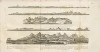
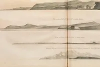
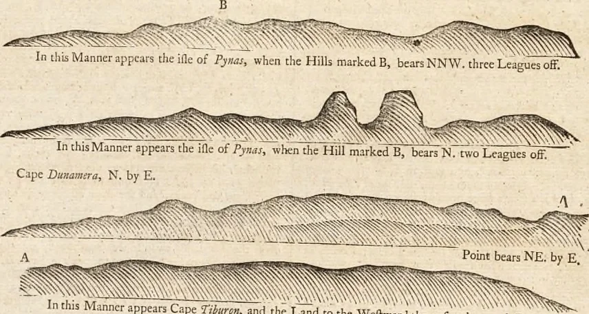
An illustration from The English pilot. [cartographic material] : The fourth book. Describing The West-India navigation, from Hudson's Bay to the River Amazones. Particularly delineating The Sea Coasts, Capes, Headlands, Rivers, Bays, Roads, Havens, Harbours, Streights, Rocks, Sands, Shoals, Banks, Depths of Water, and Anchorage, with all the Islands therein, as Jamaica, Cuba, Hispaniola, Barbadoes, Antigua, Bermudas, Porto Rico, and the rest of the Caribbee and Bahama Islands. Also, A new Description of Newfoundland, New England, New York, East and West New- Jersey, Dellawar Bay, Virginia, Maryland, Carolina. showing, The Courses and Distances from one Place to another; the Ebbing and Flowing of the Sea, the Setting of the Tides and Currents, &c. With many other Things necessary to be known in Navigation., 1775, leaf 109
ward of PertoBellowhich IS long and flac,is full of Ma>,,^revci,i,tv,r to which iflandyou have 9 or 10 fath. water very goodground.but round theifland, and to the leewartl its fiat and full of breakers. Weltby N. from Perlo Belle 30 miles, lays point de Naos, and WhalfN. about 30 leagues from… … In .h,. M™„ .pp„„ C.p= «„„ „d the Land „ ,hc W.Il..rd ,h™f wh„ „ h Po „,bears as you fee about 4 or 5 Leagues off ranroni

Pilot guides · Nautical charts · Navigation

Internet Archive · Boston Public Library · Public Domain Mark 1.0. Free to use for anything.
More pictures from The English pilot. [cartographic material] : The fourth book. Describing The West-India navigation, from Hudson's Bay to the River Amazones. Particularly delineating The Sea Coasts, Capes, Headlands, Rivers, Bays, Roads, Havens, Harbours, Streights, Rocks, Sands, Shoals, Banks, Depths of Water, and Anchorage, with all the Islands therein, as Jamaica, Cuba, Hispaniola, Barbadoes, Antigua, Bermudas, Porto Rico, and the rest of the Caribbee and Bahama Islands. Also, A new Description of Newfoundland, New England, New York, East and West New- Jersey, Dellawar Bay, Virginia, Maryland, Carolina. showing, The Courses and Distances from one Place to another; the Ebbing and Flowing of the Sea, the Setting of the Tides and Currents, &c. With many other Things necessary to be known in Navigation.

More like this