Hydrographical surveying : a description of means and methods employed in constructing marine charts (1920)
Wharton, W. J. L. (William James Lloyd), 1843-1905, Field, Arthur Mostyn, 1855- · London : J. Murray · leaf 150
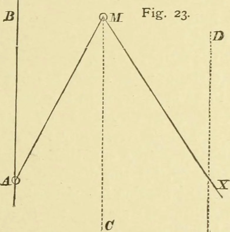
y, due to the bearing anddistance of the object, must be calculated and apphed to ourbearing, before we can use it as a bearing from the object. Here, Fig. 23, let B A be the original meridian drawn atthe commencement of plotting through any station A. M isthe distant mountain. At X our main points… … If we have the sheet graduated, it will not much simplifymatters, as it is a great chance if a meridian passes closeenough to M to use it without further correction ; but let ussuppose that we have no other meridian on the chart butA B. We must lay off the true bearing from M, with A asthe zero, so…
Hydrographic surveying · Nautical charts
Internet Archive · Biodiversity Heritage Library · Public Domain Mark 1.0. Free to use for anything.