Hydrographical surveying : a description of means and methods employed in constructing marine charts (1920)
Wharton, W. J. L. (William James Lloyd), 1843-1905, Field, Arthur Mostyn, 1855- · London : J. Murray · leaf 283
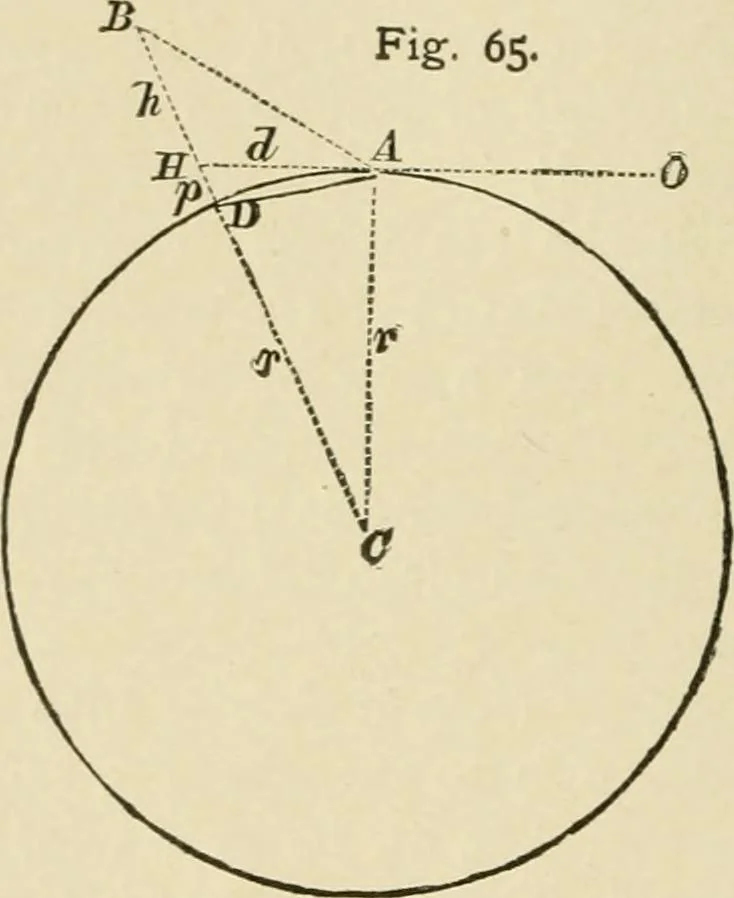
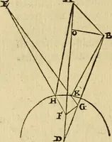
t below the tangent. Thus, in Fig. 65, A is the position of the observer, A H thetangent to the earths surface at his position, B a mountainpeak whose height, B D, we want to obtain. The angle ofelevation measured by a theodolite is B A H, and it is evidentthat the height we shall obtain by working… … D C A at the centre of the earth ; but our figure is muchexaggerated to show things clearly, and in practice the dis-tances we use to get elevations are so insignificant, compara-tively, to the diameter of the earth, and consequently the angleD C A so small, that we can neglect this quantity…
Hydrographic surveying · Nautical charts
Internet Archive · Biodiversity Heritage Library · Public Domain Mark 1.0. Free to use for anything.