Hydrographical surveying : a description of means and methods employed in constructing marine charts (1920)
Wharton, W. J. L. (William James Lloyd), 1843-1905, Field, Arthur Mostyn, 1855- · London : J. Murray · leaf 288
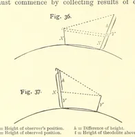
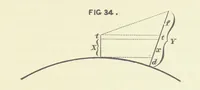
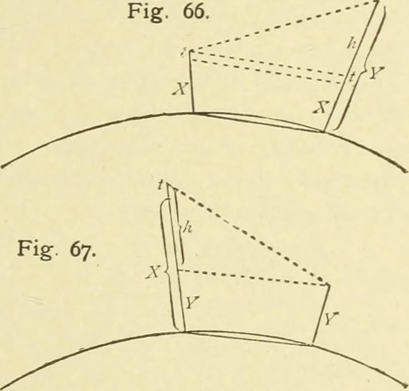
nd the angle is one of elevation. 4. Ditto, w hen angle is one of depression. CHAP. XI.] HEIGHTS 265 To understand the mode of combining the data, let usconsider the Figs. 66 and 67. In Fig. 66, Avhich is the case where the angle observed isof elevation, and comprises Problems 1 and 3, we may… … X=Height of observers position.Y = Height of observed position. 7i=Difiference of height. < = Height of theodo;ite above ground. In Fig. 67, the case where the observed angle is one ofdepression, and comprises Problems 2 and 4,Suppose X known (Problem 2), to find Y, Y={X+t)-h 2. Suppose Y known…
Hydrographic surveying · Nautical charts
Internet Archive · Biodiversity Heritage Library · Public Domain Mark 1.0. Free to use for anything.
![An illustration from Works. Popular edition.] 2 series (1886)](https://img.insideoutlibrary.com/img/200/bl-bl_003191336_9-374-1.webp)