Military sketching and map reading; including panoramic sketching and aerial photography (1921)
Grieves, Loren Chester, 1878- · Washington : United States Infantry Association · leaf 59
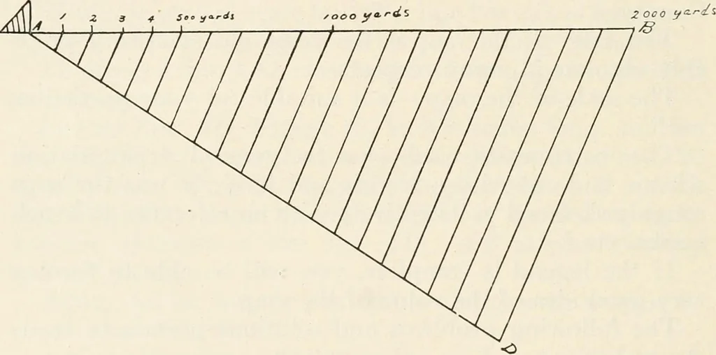
itary Sketching and Map Reading R.F. = 1/25,000. Construct a reading scale to readyards. Show 2,000 yards.Solution:R.F. = 1/25,000 means that one inch on the map repre-sents 25,000 inches on the ground, hence 1 inch (map) = 25,000 inches (ground) = 694.4 yds.(ground). Since 1 inch on the map… … Fig. 17. 3. A map at its bottom has a remark reading R.F. =1/10560 and a graphical scale. You have not the originalbut a photographic copy that is only half the dimensionsof the original. Both map and scale were reduced in thephotograph, and the photograph shows the R.F. as it readon the original.…
Maps, Military · Military sketching
Internet Archive · California Digital Library · Public Domain Mark 1.0. Free to use for anything.