Maps and map-making; three lectures delivered under the auspices of the Royal geographical society (1910)
Reeves, Edward Ayearst, 1862-1945, Royal Geographical Society (Great Britain) · London, The Royal geographical society · leaf 143
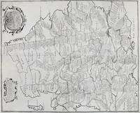
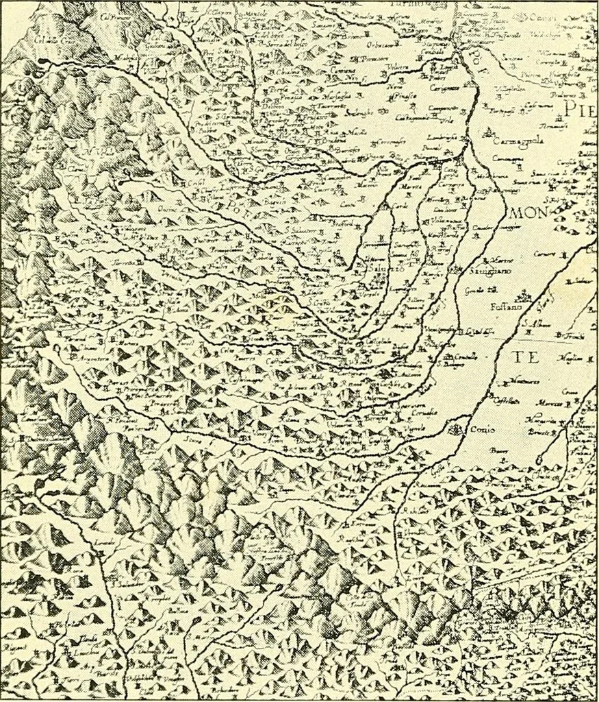
orizontal, is, I feelsure, a mistake.Models are alwaysexpensive and awk-ward things tohandle, and in mostcases quite impos-sible ; therefore weare compelled to resort to some more or less conventionalmethod of representing hill features. Doubtless the earliest of all these methods was to drawranges… … Fig. 120.—Early Method of showing Mountains on Maps. MAP CONSTRUCTION 123 the sixteenth century, and the example here given (Fig. 120)is from Maginis map of Italy, 1620. The system wasall right in its way, and was certainly picturesque, but,naturally, when accurate maps were required, it had to…
Cartography · Surveying
Internet Archive · Wellesley College Library · Public Domain Mark 1.0. Free to use for anything.
![An illustration from Travels through the Southern Provinces of the Russian Empire in 1793 and 1794. Translated from the German [by F. W. Blagdon]. MS. notes (1812)](https://img.insideoutlibrary.com/img/200/bl-bl_002753914_2-636-1.webp)
![An illustration from Rambles in the Pyrenees and the adjacent districts, Gascony, Pays de Foix [and] Roussillon (1912)](https://img.insideoutlibrary.com/img/200/ia-ramblesinpyrene00jack-499-145.webp)