A treatise on levelling, topography, and higher surveying (1876)
Gillespie, W. M. (William Mitchell), 1816-1868, Staley, Cady, b. 1840, ed · New York, D. Appleton and company · leaf 167
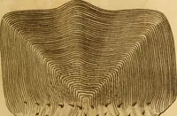
mmmmmm Beyond four fathoms, the depths are noted in fathoms andvulgar fractions. 146 LEVELLING, TOPOGRAPHY, AND HIGHER SURVEYING. (230.) Various conventional signs are used; some of theprincipal ones are given in Figs. 174-194: Fig. 174.Rocky shore. Fig. 175. Fig. 176. Rocks always bare. Low,… … Fig. 177. Fig. 178. =S Rocks sometimesbare. Fig. 179.Sandy shore, with hillocks.
Surveying
Internet Archive · Library of Congress · Public Domain Mark 1.0. Free to use for anything.