Geological and topographical maps, their interpretation and use, a handbook for the geologist and civil engineer (1911)
Dwerryhouse, Arthur Richard, 1867- · London, E. Arnold · leaf 76
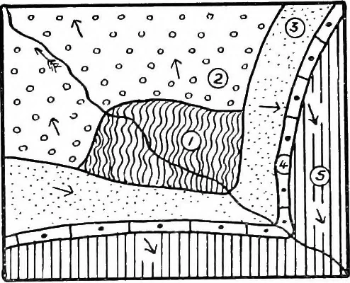
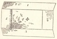
ps are V-shaped,the apex of the V pointing up stream. These beds restunconformably upon pre-Cambrian Schists and Old RedSandstone, the latter dipping down stream at an anglegreater than that of the slope of the stream course. Inconsequence of this the outcrop of the Old Red Sandstoneis also… … Decussating Folds.—Re-gions of folded strata are Fig. 40.—Inlier in Glen Bally-emon, Co. Antrim. (1) Schist ;(2) Old Red Sandstone ; (3)sometimes affected by later Trias. (4) Cretaceous; (5) Ter-folds striking in a different tiary Basalt,direction, and in this way extremely complex outcrops are…
Cartography · Geology · Topographical drawing
Internet Archive · Cornell University Library · Public Domain Mark 1.0. Free to use for anything.