Geological and topographical maps, their interpretation and use, a handbook for the geologist and civil engineer (1911)
Dwerryhouse, Arthur Richard, 1867- · London, E. Arnold · leaf 91
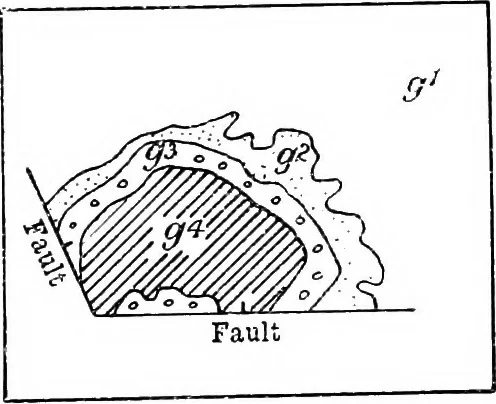
by theamount yz. With a greater throw the outcrops may be concealedor duplicated as seen in Fig. 57 a and b. a O a c 0 o a o o o O o G o o -T- . 1 , , 1 . 1 . 1 . 1 , 1 , 1 ^-L— -!-j—J—■— -. 1 , 1 , 1 n—L I 1 J—, , 3^ ° *J^ —-J-- ;& /* h:. Fig. 58.—Plan of Outcrops in the Neighbourhood of… … W////, ;::::• rr^i^mM ~^K: * o J, a ° J % • _^Sfr:i- Wk Fig. 59.—Plan of Bredon Hill, -^ 60_A Fau]ted Inlier< a Faulted Outlier. g\ LowerLias ; g% Middle Lias ; (f,Upper Lias; #\ InferiorOolite. inspection proves to be due to repetition of beds by thefault. Outliers and Inliers produced by…
Cartography · Geology · Topographical drawing
Internet Archive · Cornell University Library · Public Domain Mark 1.0. Free to use for anything.