Fijnje van Salverda, Johannes Gerardus Wybo, 1822-1900, Waring, George E. (George Edwin), 1833-1898 · New York, D. Appleton & co. · leaf 57
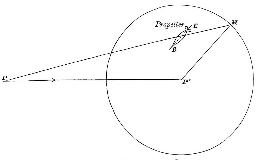
AERIAL NAVIGATION. 44: period of its travel. Its axis is parallel to the line PM. M is the point reached by the boat B E at the end of an hour. P P1 is the distance representing the velocity, V, of the wind in one hour. … Fig. 3. P1 M is the distance travelled by the boat B E in one hour, v. P M is the distance representing the actual travel of the boat in one hour as seen from the ground. The sketch shows the propeller as placed at the for- ward end of the boat. The actual speed of the boat is therefore dependent…
Aeronautics
Internet Archive · Cornell University Library · Public domain (published before 1931). Free to use for anything.