Maps and map-making; three lectures delivered under the auspices of the Royal geographical society (1910)
Reeves, Edward Ayearst, 1862-1945, Royal Geographical Society (Great Britain) · London, The Royal geographical society · leaf 85
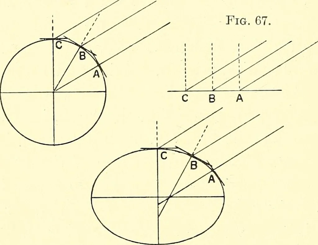
le, no matter how many miles a mantravelled north or south, since the vertical lines passingthrough the observers position would be parallel with oneanother. It is evident, then, that if, as in Fig. 68, theearths figure deviates from a perfect sphere and tends toflatten at the poles, the number of… … Fig. 68. SURVEY METHODS 67 the same angle, increase in length ; and it is principally fromthis measured difference in the length of a degree, or certainnumber of degrees, that the figure of the earth has beendetermined. As we have stated, another method of finding the truefigure of the earth is by…
Cartography · Surveying
Internet Archive · Wellesley College Library · Public Domain Mark 1.0. Free to use for anything.