Finch, James Kip, 1883- · New York : John Wiley & Sons, Inc. · leaf 109
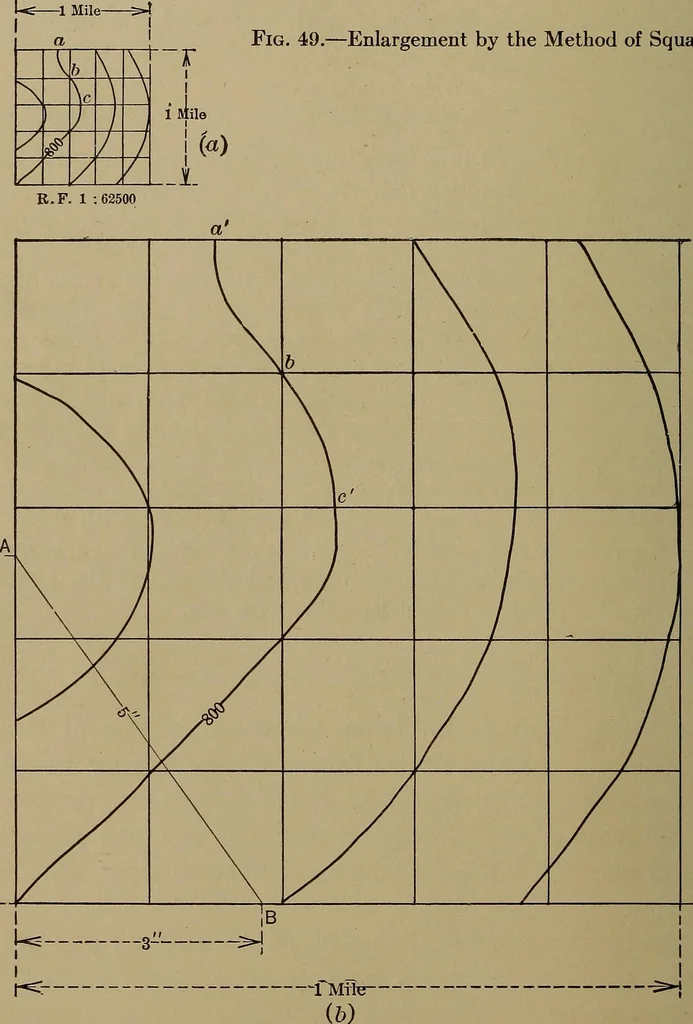
d use the data shown on the U. S. G. S. map as a basisfor a complete military sketch. That is, we could enlargethis section, then go out in the field and sketch in a large numberof details not shown on the U. S. G. S. map. 88 TOPOGRAPHIC DRAFTING The procedure would be as follows: 1. Compute the… … r~i one square mile and covering the required section of the U. S.G. S. map. 3. Divide this square into say twenty-five smaller squaresby dividing each side into five equal parts. This may be done ENLARGEMENT AND REDUCTION 89 by trial, with a scale (see Fig. 24) or by the method used inconstructing…
Cartography · Military maps
Internet Archive · Library of Congress · Public Domain Mark 1.0. Free to use for anything.