Finch, James Kip, 1883- · New York : John Wiley & Sons, Inc. · leaf 115
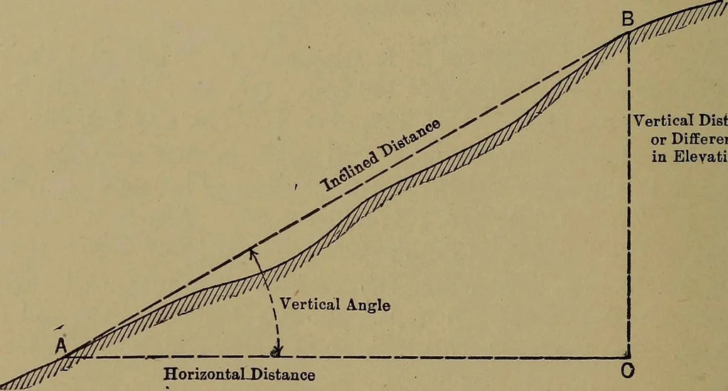
ak of distance we meanhorizontal distance. In sketch mapping the method used for measuring distanceis pacing. In measuring distance in this way two differentplans can be followed: 1, by careful pacing between points,which have been accurately laid out with a tape, the pacermay so adjust his pace… … Fig. 53.—Profile Showing Distance Measurements. mapping and other work; 2, the pacer can use his naturalpace and find out how many inches this is. Any distancecan then be measured in paces and the number of paces con-verted to inches, feet or yards. The latter is the procedurefollowed in military…
Cartography · Military maps
Internet Archive · Library of Congress · Public Domain Mark 1.0. Free to use for anything.