Grieves, Loren C. (Loren Chester), b. 1878 · Washington, United States Infantry Association · leaf 73
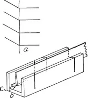
on the board, draw astraight line in the direction Ab. Next, pace the distance fromA to B, and, with your scale of paces, 3 = 1 mile, lay oflF theline, ab, representing the distance AB. In locating the initialpoint a, one usually-knows the general direction of the courseto be sketched, and should… … Fig.b
Maps, Military · Military topography
Internet Archive · Cornell University Library · Public Domain Mark 1.0. Free to use for anything.