U.S. Army Command and General Staff College · Fort Leavenworth, Kan. : The General Service Schools Press · leaf 94
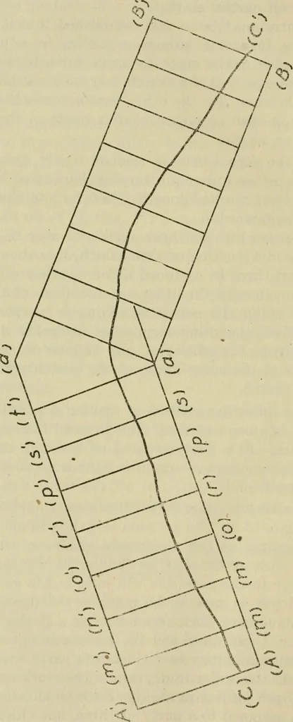
ude the general line.The total depth of area to be mapped will depend on thetime and number of sketchers available. If the sketchersare skilled in their work and the terrain is not very diffi-cult, the entire area may be dividedinto parts one-half milein length and two miles in depth and the work… … X APPLIED MILITARY SKETCHING 85 all the parties to the point A where the most distant visiblepoint of the base or control line, as (a), is pointed out toall chiefs of parties. Sketcher No. 1 of the first party, de-signated as party (A), determines the magnetic bearing ofthe line (A a) from which…
Military topography · Maps, Military
Internet Archive · Library of Congress · Public Domain Mark 1.0. Free to use for anything.