Hinks, Arthur R. (Arthur Robert), 1873-1945 · Cambridge : University press · leaf 177
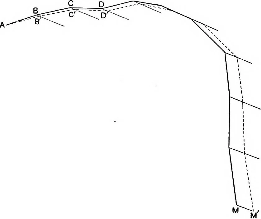
and proceedas before. In this way the road can be drawn in, leg by leg,until it comes out again into open country, and the whole canthen be checked by a plane table fixing. Probably the result ofthis will not agree with the position as carried through by thetraverse, and it will be necessary to… … Fig. 17. Adjustment of traverse. The full line is the original; the dottedline is the traverse adjusted to close on M. required to adjust the traverse so that it closes on M. JoiaMM and draw lines parallel to MM through each angularpoint of the traverse. Each of these points must be movedalong its…
Maps · Surveying
Internet Archive · Cornell University Library · Public Domain Mark 1.0. Free to use for anything.